Pays/Territoires

Mise à jour 2021-01-12 18:58:07

Les noms des pays/territoires du monde sont donnés en Français et Chinois. Cette collection des précieuses terres fermes du monde que toute l'humanité partage inclut non seulement les pays indépendants, mais aussi des régions spécifiques qui ne sont pas membre de l'ONUOrganisation des Nations Unies: Nous, peuples des Nations Unies ... Une ONU plus forte pour un monde meilleur. Veuillez aussi consulter les noms des pays en masculin et féminin en Français.

En Français, les noms des pays ont le genre masculin et féminin. La majorité des pays jeunes ont leur nom en masculin, comme Ouganda, Congo. Tandis que les pays historiques ont leur genre déterminé en terminaison du mot en Français. La Chine est féminine comme la majorité des pays d'Europe sauf Andorre, Chypre, Malte, Monaco, Saint-Marin, le Danemark, le Luxembourg, le Liechtenstein, le Monténégro. les Pays-Bas, le Portugal et le Vatican (cf. Noms Pays masculins féminins).

Ainsi la colonne du genre sera présentée comme suit : ♂Masulin, ♀Féminin, Neutre.

GéoPays    Fermer
Monde | Pays/Territoires | Régions en Chine | Provinces de Chine | Régions en France | Départements de France | Provinces du Monde | Villes/Villages | Localités | Continents du Monde | Vins AOP

11

id
Pays
Pays en Anglais
Clipperton Island
Pays
Ile de Clipperton
countryucasefr
ILE DE CLIPPERTON
Pays en Chinois
Pays en Espagnol
Isla De Clipperton
Pays en Italien
Isola Di Clipperton
Pays en Portugais
Console De Clipperton
Pays en Allemand
Insel Clipperton
countryfull
Clipperton Island
countrynm
Clipperton Island
ISO2
PYFC
ISO3
PYFC
countrycodeisono
258
countrycodeirs
IP
countrycodeirsfr
IP
countrycodeirsmixt
IP
♀Féminin
15
6
57
2
currencypxcode
EUR
Préfixe Tél.
689
Superficie km2
100
arealand
6
coastline
11.1
timezonedeltabegin
-8
flaglink
maplink
ip-map.gif
visapassenger
-1
rankincome
222
location
Middle America, atoll in the North Pacific Ocean, 1,120 km southwest of Mexico
terrain
coral atoll
naturalresources
fish
cooking
Middle America, atoll in the North Pacific Ocean, 1,120 km southwest of Mexico
9
rgbback
16777215
todate
1

12

id
Pays
Pays en Anglais
Cocos (Keeling) Islands
Pays
Iles Cocos-Keeling
countryucasefr
ILES COCOS-KEELING
Pays en Chinois
Pays en Espagnol
Isla De Cocos (Keeling)
Pays en Italien
Isola Di Cocos (Keeling)
Pays en Portugais
Console De Cocos (Keeling)
Pays en Allemand
Insel Cocos (Keeling)
countryfull
Cocos (Keeling) Islands
countrynm
Cocos (Keeling) Islands
ISO2
CC
ISO3
CCK
countrycodeisono
166
countrycodeirs
CK
countrycodeirsfr
CK
countrycodeirsmixt
CK
♀Féminin
12
6
51
10
currency
dollar
currencyisocode
AUD
currencyisocodefull
AUD 036
currencypxcode
AUD
currencysymbol
A$
currencysubdivision
100 cents
currencyregime
float
currencyvalue
0.7485
Capitale
West
capitalfr
West
Préfixe Tél.
61
Superficie km2
14,15
arealand
14
coastline
26
timezonedeltabegin
6.5
flaglink
maplink
ck-map.gif
visapassenger
-1
largestcity
West
Population
625
rankincome
222
president
Reine Elizabeth II
location
Southeastern Asia, group of islands in the Indian Ocean, southwest of Indonesia, about halfway from Australia to Sri Lanka
terrain
flat, low-lying coral atolls
naturalresources
fish
cooking
Southeastern Asia, group of islands in the Indian Ocean, southwest of Indonesia, about halfway from Australia to Sri Lanka
9
rgbback
16777215
todate
1

13

id
Pays
Pays en Anglais
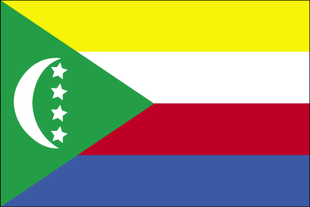
Comoros
Pays
Comores
countryucasefr
COMORES
Pays en Chinois
Pays en Espagnol
El Comoro
Pays en Italien
Le Comore
Pays en Portugais
Cômoros
Pays en Allemand
Comoren
countryfull
Comoros
countrynm
Comoros
ISO2
KM
ISO3
COM
countrycodeisono
174
countrycodeolympic
COM
countrycodeirs
CN
countrycodeirsfr
CN
countrycodeirsmixt
CMR
♀Féminin
15
2
57
languagesfr
Français
119
currency
franc
currencyfr
franc C.F.A.
currencyisocode
KMF
currencyisocodefull
KMF 174
currencypxcode
KMF
currencysymbol
CF
currencysubdivision
-
currencyregime
Euro (491.96775)
currencyvalue
0.00257
Capitale
Moroni
capitalfr
Moroni
Préfixe Tél.
269
Superficie km2
2 171
arealand
2 170
landarablerate
0.3498
landforestrate
0.043
coastline
340
summit
Kartala 2 361 m.
timezonedeltabegin
3
flaglink
maplink
kmcolor.gif
outlinemaplink
kmout.gif
visapassenger
-1
maincities
Mutsamudu, Fomboni, Mitsamiouli.
largestcity
Moroni
largestcitypopulation
36 000
rankpopulation
160
Population
600 000
rankgdp
174
gdp
323000000
rankgdpppp
157
gdpppp
1029000000
rankgni
197
gni
269000000
rankincomeorigin
169
rankincome
183
income
450
rankincomeppp
172
incomeppp
1720
lifeexpectation
61.57
alphabetizationrate
0.563
natalityrate
0.038
fecondity
4.9
mortalityrate
0.00863
mortalityrateinfantile
0.07722
hdi
0.528
urbanization
0.338
nationalevent
Independence Day
nationaleventfr
Jour de l'Indépendance
nationalholiday
6 July (1975)
Date de naissance aaaa-mm-jj
1975-07-06 00:00:00
2
4
location
Southern Africa, group of islands at the northern mouth of the Mozambique Channel, about two-thirds of the way between northern Madagascar and northern Mozambique
terrain
volcanic islands, interiors vary from steep mountains to low hills
naturalresources
NEGL
9
Web
rgbback
16777215
todate
1

14

id
Pays
Pays en Anglais
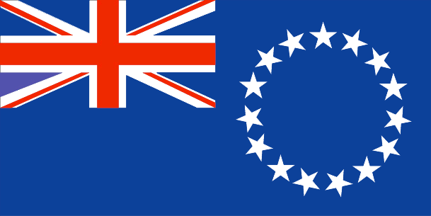
Cook Islands
Pays
Cook (îles)
countryucasefr
COOK (ILES)
Pays en Chinois
Pays en Espagnol
Islas De Cocinero
Pays en Italien
Isole Di Cuoco
Pays en Portugais
Consoles De Cozinheiro
Pays en Allemand
KochcInseln
countryfull
Cook Islands
countrynm
Cook Islands
ISO2
CK
ISO3
COK
countrycodeisono
184
countrycodeolympic
COK
countrycodeirs
CW
countrycodeirsfr
CW
countrycodeirsmixt
CW
♀Féminin
18
6
57
75
currency
dollar
currencyisocode
NZD
currencyisocodefull
NZD 554
currencypxcode
EUR
currencysymbol
NZ$
currencysubdivision
100 cents
currencyregime
float
currencyvalue
0.6966
Capitale
Avarua
capitalfr
Avarua
Préfixe Tél.
682
Superficie km2
236
arealand
240
landarablerate
0.1739
landforestrate
0.957
coastline
120
timezonedeltabegin
-10
flaglink
maplink
ckcolor.gif
outlinemaplink
ck.gif
visapassenger
-1
largestcity
Avarua
rankpopulation
214
Population
20 407
rankgni
210
gni
70000000
rankincomeorigin
94
rankincome
96
income
3500
nationalevent
Constitution Day
nationaleventfr
Jour de la Constitution
nationalholiday
First Monday in August (1965)
Date de naissance aaaa-mm-jj
1965-08-01 00:00:00
2
6
location
Oceania, group of islands in the South Pacific Ocean, about one-half of the way from Hawaii to New Zealand
terrain
low coral atolls in north; volcanic, hilly islands in south
naturalresources
NEGL
9
rgbback
16777215
todate
1

15

id
Pays
Pays en Anglais
Coral Sea Islands
Pays
Iles de la Mer Corail
countryucasefr
ILES DE LA MER CORAIL
Pays en Chinois
Pays en Espagnol
Territorio De las Islas Del Mar De Cora
Pays en Italien
Territorio Delle Isole Del Mare Di Cora
Pays en Portugais
Território Dos Consoles Do Mar De Cora
Pays en Allemand
INSELCGegend Cora See
countryfull
Coral Sea Islands
countrynm
Coral Sea Islands
ISO2
AUSC
ISO3
AUSC
countrycodeisono
036
countrycodevehicle
AUS
countrycodeolympic
AUS
countrycodeirs
CR
countrycodeirsfr
CR
countrycodeirsmixt
CR
♀Féminin
12
7
51
10
currencypxcode
AUD
Préfixe Tél.
61
arealand
3
coastline
3095
timezonedeltabegin
11
flaglink
maplink
cr-map.gif
visapassenger
-1
rankincome
222
president
Reine Elizabeth II
location
Oceania, islands in the Coral Sea, northeast of Australia
terrain
sand and coral reefs and islands (or cays)
naturalresources
NEGL
cooking
Oceania, islands in the Coral Sea, northeast of Australia
9
rgbback
16777215
todate
1

16

id
Pays
Pays en Anglais
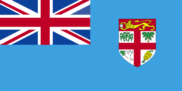
Fiji
Pays
Fidji
countryucasefr
FIDJI
Pays en Chinois
Pays en Espagnol
Las Islas Fiji
Pays en Italien
Le Isole Figi
Pays en Portugais
Consoles De Fiji
Pays en Allemand
Fidschi-Inseln
countrypy
fei3 ji4
countrylocal
Fiji
countryfull
Fiji
countrynm
Fiji
ISO2
FJ
ISO3
FJI
countrycodeisono
242
countrycodevehicle
FJI
countrycodeolympic
FIJ
countrycodeirs
FJ
countrycodeirsfr
FJ
countrycodeirsmixt
FJ
♀Féminin
15
6
51
languagesfr
Anglais
40
currency
dollar
currencyfr
dollar fidjien
currencyisocode
FJD
currencyisocodefull
FJD 242
currencypxcode
FJD
currencysymbol
F$
currencysubdivision
100 cents
currencyregime
composite
currencyvalue
0.5944
Capitale
Suva
capitalfr
Suva
Préfixe Tél.
679
Superficie km2
18 270
arealand
18 270
landarablerate
0.1095
landforestrate
0.446
coastline
1129
summit
Mount Tomaniivi 1 324 m.
timezonedeltabegin
12
flaglink
maplink
fjcolor.gif
outlinemaplink
fj.gif
visapassenger
-1
maincities
Lautoka, Nadi, Lambasa, Singatoka, Nausori, Levuka.
largestcity
Suva
largestcitypopulation
166 000
rankpopulation
154
Population
835 000
rankgdp
141
gdp
2036000000
rankgdpppp
141
gdpppp
4910000000
rankgni
153
gni
1871000000
rankincomeorigin
103
rankincome
113
income
2240
rankincomeppp
109
incomeppp
5650
lifeexpectation
69.2
alphabetizationrate
0.937
natalityrate
0.02291
mortalityrate
0.00568
mortalityrateinfantile
0.01299
hdi
0.754
urbanization
0.502
nationalevent
Independence Day
nationaleventfr
Jour de l'Indépendance
nationalholiday
Second Monday of October (1970)
Date de naissance aaaa-mm-jj
1970-10-01 00:00:00
7
11
location
Oceania, island group in the South Pacific Ocean, about two-thirds of the way from Hawaii to New Zealand
terrain
mostly mountains of volcanic origin
naturalresources
timber, fish, gold, copper, offshore oil potential
cooking
Fruits de Mer
9
Web
rgbback
16777215
todate
1
Notes
Fruits de Mer

17

id
Pays
Pays en Anglais
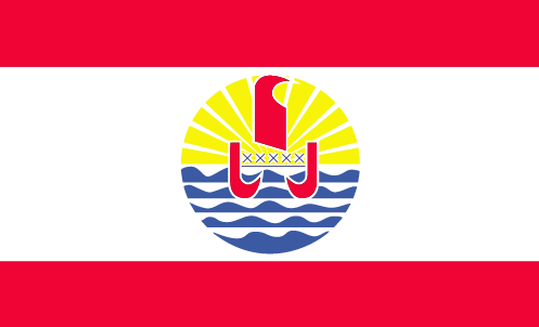
French Polynesia
Pays
Polynésie française
countryucasefr
POLYNESIE FRANCAISE
Pays en Chinois
Pays en Espagnol
Polinesia Francesa
Pays en Italien
Polynesia Francese
Pays en Portugais
Polynesia Francês
Pays en Allemand
Französischer Polynesia
countryfull
French Polynesia
countrynm
French Polynesia
ISO2
PF
ISO3
PYF
countrycodeisono
258
countrycodeirs
FP
countrycodeirsfr
FP
countrycodeirsmixt
FP
♀Féminin
15
6
57
2
currency
franc
currencyfr
euro
currencyisocode
XPF
currencyisocodefull
XPF 953
currencypxcode
XPF
currencysymbol
CFPF (Comp
currencysubdivision
100 centimes
currencyregime
Euro (119.253)
currencyvalue
0.01025
nationalityfr
Française
Capitale
Papeete
capitalfr
Papeete
Préfixe Tél.
689
Superficie km2
3 941
arealand
3 660
areawater
507
landarablerate
0.0164
landforestrate
0.287
coastline
2525
timezonedeltabegin
-10
flaglink
maplink
pfcolor.gif
outlinemaplink
pf.gif
visapassenger
-1
largestcity
Papeete
rankpopulation
174
Population
243 000
rankgni
123
gni
4360000000
rankincomeorigin
28
rankincome
28
income
18167
lifeexpectation
75.67
alphabetizationrate
0.98
natalityrate
0.01734
mortalityrate
0.00458
mortalityrateinfantile
0.00861
urbanization
0.68
nationalevent
Bastille Day
nationaleventfr
Jour de la prise de la Bastille
nationalholiday
14 July (1789)
Date de naissance aaaa-mm-jj
1789-07-14 00:00:00
6
10
location
Oceania, archipelago in the South Pacific Ocean, about one-half of the way from South America to Australia
terrain
mixture of rugged high islands and low islands with reefs
naturalresources
timber, fish, cobalt, hydropower
cooking
Canne à sucre.
2
rgbback
16777215
todate
1
Notes
Canne à sucre.

18

id
Pays
Pays en Anglais
French Southern and Antarctic Lands
Pays
Terres Australes et antarctiques françaises
countryucasefr
TERRES AUSTRALES ET ANTARCTIQUES FRANCAISES
Pays en Chinois
Pays en Espagnol
Tierras Meridionales Y Antárticas Francesas
Pays en Italien
Terre Del sud & Antartiche Francesi
Pays en Portugais
Terras Do sul & Antarctic Francesas
Pays en Allemand
Französische Südliche U. Antarktische Länder
countryfull
French Southern and Antarctic Lands
countrynm
French Southern and Antarctic Lands
ISO2
TF
ISO3
ATF
countrycodeisono
260
countrycodeirs
FS
countrycodeirsfr
FS
countrycodeirsmixt
FS
♀Féminin
15
6
57
2
currencyfr
euro
currencypxcode
EUR
currencysymbol
nationalityfr
Française
Superficie km2
7 829
arealand
7 829
coastline
1232
timezonedeltabegin
5
flaglink
maplink
fs-map.gif
visapassenger
-1
rankincome
222
location
southeast of Africa, islands in the southern Indian Ocean, about equidistant between Africa, Antarctica, and Australia; note - French Southern and Antarctic Lands include Ile Amsterdam, Ile Saint-Paul, Iles Crozet, and Iles Kerguelen in the southern India
terrain
volcanic
naturalresources
fish, crayfish
9
rgbback
16777215
todate
1

19

id
Pays
Pays en Anglais
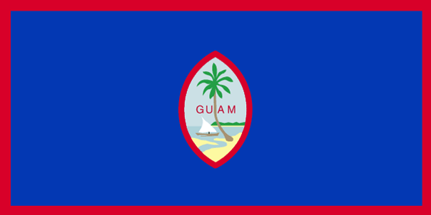
Guam
Pays
Guam
countryucasefr
GUAM
Pays en Chinois
Pays en Espagnol
Guam
Pays en Italien
Il Guam
Pays en Portugais
Guam
Pays en Allemand
Guam
countryfull
Guam
countrynm
Guam
ISO2
GU
ISO3
GUM
countrycodeisono
316
countrycodeolympic
GUM
countrycodeirs
GQ
countrycodeirsfr
GQ
countrycodeirsmixt
GQ
♂Masulin
17
6
51
6
currency
dollar
currencyfr
dollar
currencyisocode
USD
currencyisocodefull
USD 840
currencypxcode
USD
currencysymbol
$
currencysubdivision
100 cents
currencyregime
float
currencyvalue
1
Capitale
Agana
capitalfr
Agana
Préfixe Tél.
1-671
Superficie km2
541
arealand
549
landarablerate
0.1091
landforestrate
0.382
coastline
125.5
timezonedeltabegin
10
flaglink
maplink
guam.gif
visapassenger
-1
largestcity
Agana
rankpopulation
180
Population
166 090
rankgni
155
gni
1640000000
rankincomeorigin
53
rankincome
56
income
10789
lifeexpectation
78.12
alphabetizationrate
0.9642
natalityrate
0.01931
mortalityrate
0.00435
mortalityrateinfantile
0.00715
nationalevent
Discovery Day
nationaleventfr
Jour de la Découverte
nationalholiday
First Monday in March (1521)
Date de naissance aaaa-mm-jj
1753-01-01 00:00:00
9
9
location
Oceania, island in the North Pacific Ocean, about three-quarters of the way from Hawaii to the Philippines
terrain
volcanic origin, surrounded by coral reefs; relatively flat coralline limestone plateau (source of most fresh water), with steep coastal cliffs and narrow coastal plains in north, low hills in center, mountains in south
naturalresources
fishing (largely undeveloped), tourism (especially
9
rgbback
16777215
todate
1

20

id
Pays
Pays en Anglais
Heard Island and McDonald Islands
Pays
Ile Heard & Iles McDonald
countryucasefr
ILE HEARD & ILES MCDONALD
Pays en Chinois
Pays en Espagnol
Isla Y Islas Oídas De McDonald
Pays en Italien
Isola & Isole Sentite Di McDonald
Pays en Portugais
Console & Consoles Ouvidos De McDonald
Pays en Allemand
Gehörte Insel U. Inseln McDonald
countryfull
Heard Island and McDonald Islands
countrynm
Heard Island and McDonald Islands
ISO2
HM
ISO3
HMD
countrycodeisono
334
countrycodeirs
HM
countrycodeirsfr
HM
countrycodeirsmixt
HM
♀Féminin
12
7
51
10
currency
dollar
currencyisocode
AUD
currencyisocodefull
AUD 036
currencypxcode
AUD
currencysymbol
A$
currencysubdivision
100 cents
currencyregime
float
currencyvalue
0.7485
Superficie km2
412
arealand
412
coastline
101.9
timezonedeltabegin
5
flaglink
maplink
heard.gif
visapassenger
-1
rankincome
222
president
Reine Elizabeth II
location
islands in the Indian Ocean, about two-thirds of the way from Madagascar to Antarctica
terrain
Heard Island - 80% ice-covered, bleak and mountainous, dominated by a large massif (Big Ben) and an active volcano (Mawson Peak); McDonald Islands - small and rocky
naturalresources
fish
9
rgbback
16777215
todate
1

Plus+
A | B | C | D | E | F | G | H | I | J | K | L | M | N | O | P | Q | R | S | T | U | V | W | X | Y | Z
 

Chine | Pays/Territoires | Régions en Chine | Provinces de Chine | Régions en France | Départements de France | Provinces du Monde | Villes/Villages | Localités | Continents du Monde | Vins AOP

Envoyez vos commentaires (0)

Aucun commentaire.
Email Web

Veuillez recopier la chaîne :
Texte à recopier.

Asia Home™ > Boutique > Ile de Clipperton 克里普顿岛 => Pays/Territoires | Conditions générales de vente | Retours et remboursements | Clauses de Confidentialité | FAQ
  

Envie de venir ? | Appelez-nous 7/704 67 79 04 87 (Service Epices)

Fenêtre contextuelle    Fermer
Veuillez patienter...